A geotechnical investigation on Rue Principale near the Yamaska River reveals a completely different soil profile than one conducted upslope toward Mont Shefford. The flatlands consist predominantly of deep, compressible clay and silt deposits left by the post-glacial Champlain Sea, while the drumlin slopes and bedrock outcrops of the Appalachian piedmont present dense till and shallow refusal. These contrasts, encountered daily in Granby Quebec, make the Standard Penetration Test indispensable. Because the N-value obtained from each 300 mm drive interval directly correlates with the relative density of granular layers and the consistency of cohesive strata, the SPT provides a continuous index of the subsurface that no desk study can replicate. Coupled with grain-size analysis of the split-spoon samples, the dataset supports everything from shallow footing design in the newer residential subdivisions near Lac Boivin to deep pile specifications for commercial buildings in the city center. The technical team executing these tests works within the framework of ASTM D1586-18 and reports N60 values normalized for energy, overburden, and borehole diameter, ensuring the data aligns with the seismic hazard provisions of the National Building Code of Canada.
SPT refusal on Appalachian shale at 5 meters versus 15 meters of Champlain clay — both scenarios occur within a single Granby project boundary.
Methodology applied in Granby Quebec
Risks and considerations in Granby Quebec
A five-story residential project proposed on Boulevard Leclerc encountered a subsurface condition typical of Granby Quebec's transitional geology: 2 meters of loose sandy fill over 8 meters of very soft, normally consolidated silty clay, underlain by dense glacial till. The developer's initial budget assumed shallow spread footings with an allowable bearing pressure of 150 kPa, but the SPT blow counts in the clay layer ranged from N=2 to N=4, indicating undrained shear strengths below 30 kPa. Total and differential settlement under that load would have exceeded 50 mm, cracking partition walls and damaging interior finishes within the first five years of occupancy. By advancing the boreholes deeper and recording N-values in the underlying till at N=35 to N=45, the geotechnical team justified a switch to driven steel H-piles bearing in the dense stratum, reducing settlement to under 10 mm. This outcome, achieved before construction documents were finalized, prevented a costly redesign midway through the project and demonstrated why skipping SPT exploration in the Yamaska River lowlands is a risk no structural engineer should accept.
Our services
The SPT program in Granby Quebec is supported by a full suite of complementary field and laboratory services that transform raw blow counts into actionable design parameters.
SPT Borehole Drilling
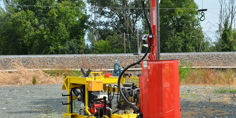
Continuous-flight hollow-stem auger drilling with SPT sampling at 1.5 m depth intervals or at stratigraphic changes, executed with calibrated automatic hammers and logged to ASTM D1586 specifications.
Soil Index Testing
Laboratory classification of SPT split-spoon samples including water content, Atterberg limits, and particle-size distribution to verify field identifications and assign USCS group symbols.
Liquefaction Screening
Evaluation of SPT N60 data for seismic soil liquefaction potential using the NCEER simplified procedure, applicable to saturated granular layers beneath Granby's water table.
Foundation Parameter Reporting
Derivation of allowable bearing capacity, modulus of subgrade reaction, and settlement estimates from corrected N-values, formatted for direct use by structural engineers in NBCC-compliant designs.
Frequently asked questions
What depth do SPT boreholes typically reach in Granby Quebec?
Borehole depth depends on the target foundation type and the depth to competent bearing. For shallow footings in the Yamaska River valley, 10 to 15 meters is common to penetrate the soft Champlain Sea clay. In areas closer to the Appalachian foothills where bedrock is shallower, 5 to 8 meters may suffice. The drilling program is designed per NBCC requirements and is always confirmed on-site based on real-time blow count data.
How much does an SPT investigation cost in Granby?
A typical SPT borehole program in Granby Quebec ranges from CA$760 to CA$1.110 per borehole, depending on access conditions, total depth, number of sampling intervals, and whether supplemental laboratory testing is included. The final quote reflects the specific site location and the number of boreholes required to meet the geotechnical scope.
What is the difference between raw N-values and N60 values?
Raw N-values are the field blow counts recorded during the SPT. N60 values are corrected for the actual hammer energy delivered to the drill rods, normalized to 60% of the theoretical free-fall energy. Energy correction is essential in Granby because different hammer types and drill rig configurations produce varying energy ratios, and NBCC site classification tables require normalized N60 data for consistency.
Can SPT data be used to classify the seismic site class?
Yes. The NBCC uses a combination of average N60 values and shear-wave velocity (Vs30) to assign site classes A through E. In Granby's soft clay zones, low N60 values often result in a Site Class D or E classification, which increases the design spectral acceleration and directly impacts the structural design. The SPT provides the N60 component, and where needed, we combine it with MASW or downhole seismic testing for the Vs30 parameter.
How soon are the SPT logs and report delivered after fieldwork?
Preliminary field logs with raw blow counts and soil descriptions are available within 24 to 48 hours of completing the boreholes. The final geotechnical report, which includes corrected N60 values, laboratory test results, foundation recommendations, and seismic site classification, is typically delivered within 10 to 12 business days after the fieldwork concludes.